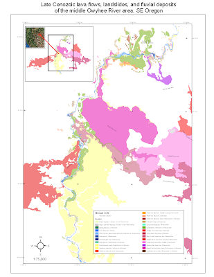
 This is what I came up with for a draft layout for the map. I will add the base material images when back at my office computer. Any votes for shaded relief vs topo or some other possibility (e.g. a combination of those, the NAIP imagery, satellite imagery)? I am traveling after noon tomorrow and will be unavailable on Thursday and Friday. Weekend is possible, but I have a talk to prepare for AGU and haven't started that yet.
The draft above shows some labels on the lava flows. I could add more or delete the ones on there. Anyone have a preference? Let me know soon.

Dr. Jerque,
ReplyDeleteI think the amount of labels is good. Could they be bigger size text without making them look silly?
Regarding the base layer, do we anticipate needing contours to show and tell folks about elevation or thicknesses of units? If not, then I'd say shaded relief or NAIP. Whatever you choose in the end, consider how large it may make the file (smaller file sizes will be easier to share if we need to send the poster to eachother over the next week).
I also wonder if the location map in the upper left corner would better show the location in SE oregon by using the outlines of the states either on top of that colorful image you have or alone as black lines on white background? (At full poster-size scale, how easy will it be to tell we're in SE oregon?)
So, we haven't really divided up the labor on actually who will assemble this poster and when. Do you want me to help just a little, assemble everything besides the map, or just lay low?
-Spud
P.S. Apparently you watch Dora the Explora' at your house?
ReplyDeletesurprised you watch it.
ReplyDelete